Knocknashee Archaeology Project

Project: The Knocknashee Archaeology Project

Location: Knocknashee, Lavagh, Tubbercurry, Co. Sligo

Year: 2016-ongoing

Client: Dr. Dirk Brandherm, Queen’s University Belfast

Funding: Royal Irish Academy Grant (2016, 2017)

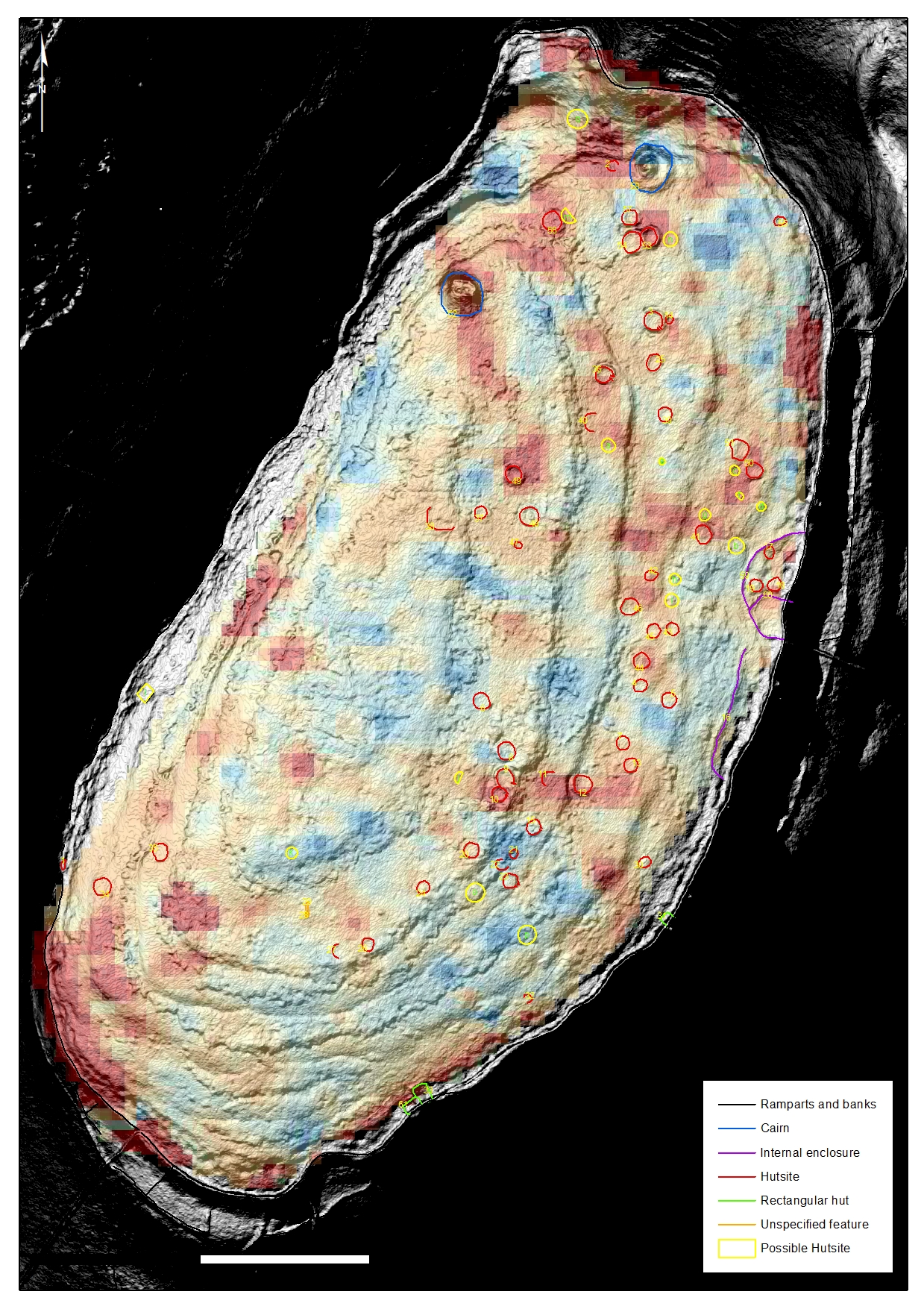
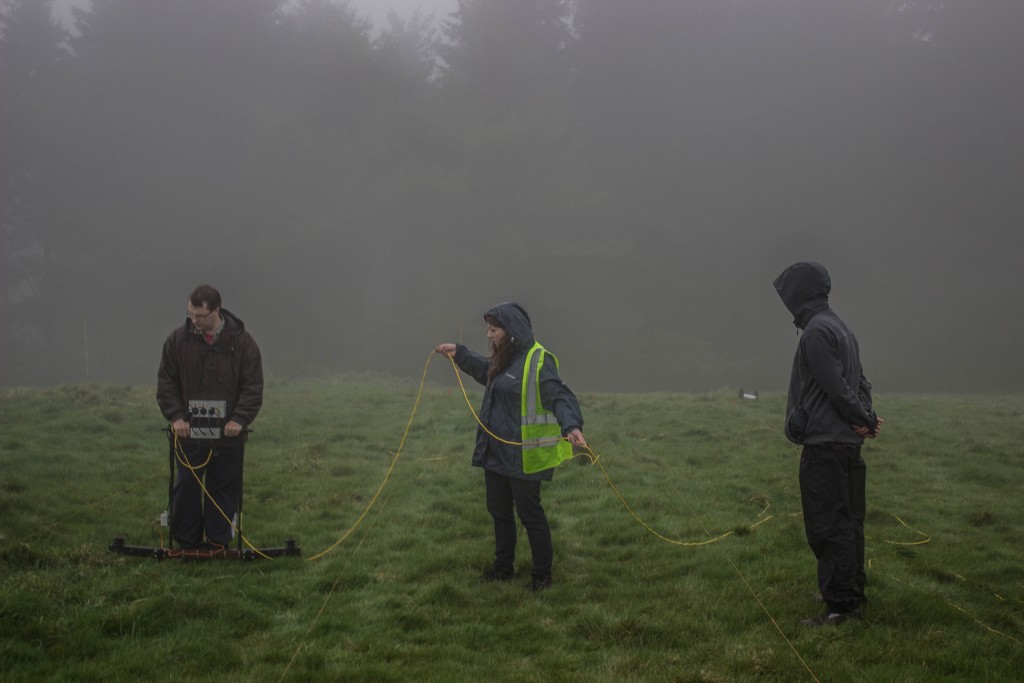
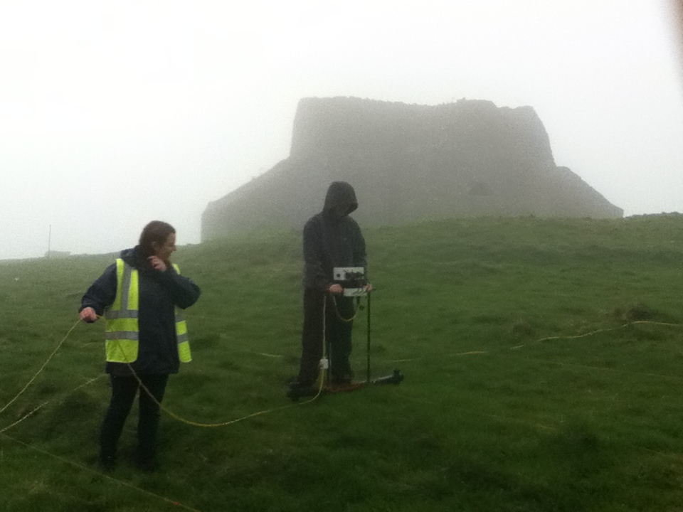
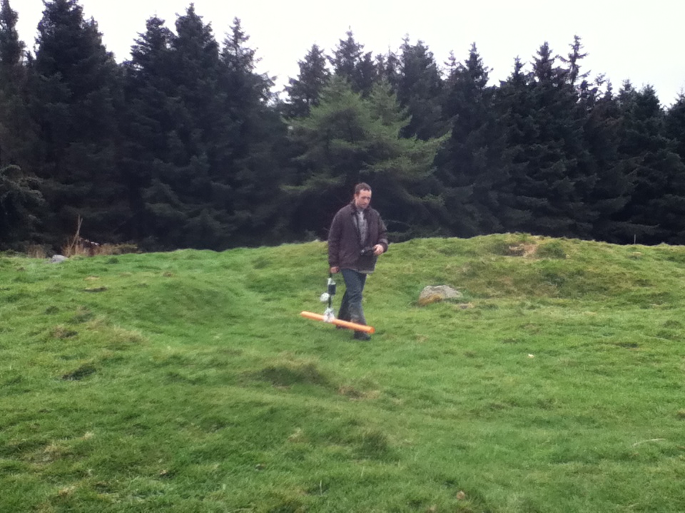
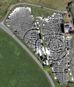
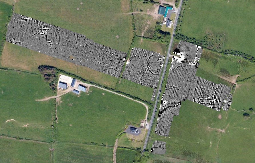
Aim: The purpose of the geophysical surveys was to assess hut sites on the plateau of Knocknashee, a hillfort complex which also contains two Passage Tombs. In 2016 the entire hillfort interior – more than 20 ha in size – was assessed with Magnetic Susceptibility to identify zonations of activity. Specific clusters of huts and enclosures were further investigated with high resolution Magnetometry and Earth Resistance surveys. The 2017 survey used the ‘Earthwalker’ Magnetometer array across the southern half of the plateau and targeted Metal Detection surveys.

Social Media: Knocknashee Archaeology Project Facebook Page

Outcomes: The 2016 geophysical survey results are currently being written up for publication in a future edition of Emania. The results were used to target a series of excavations in 2017, under the direction of Dr. Dirk Brandherm.

Community Archaeology in Athy, Co. Kildare

Project: Athy Heritage Centre-Museum, Athy, Co. Kildare.

Year: 2013, 2014, 2015, 2016

Client: Athy Heritage Centre-Museum, funded by the Irish Walled Towns NetworkThe Heritage Council.

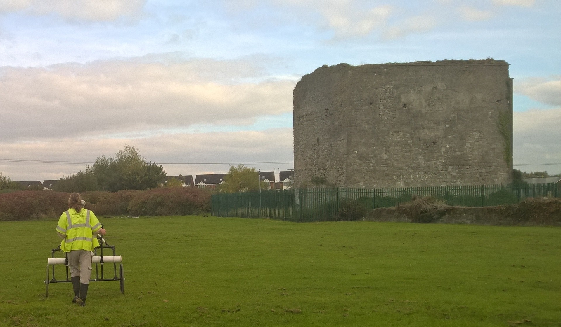
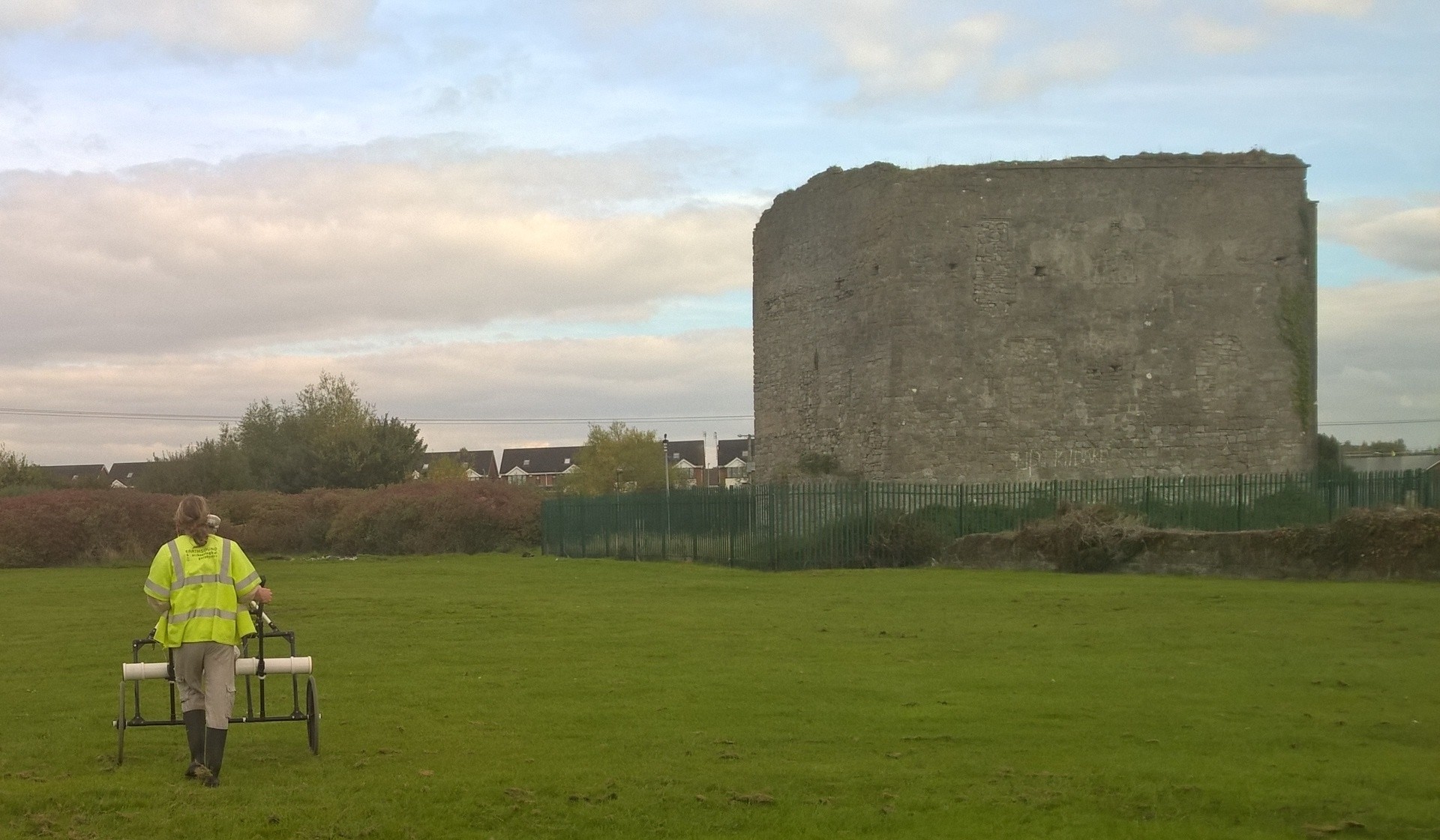
Aim: We’ve been carrying out a variety of projects in Athy since 2013. We’ve surveyed the Town Walls and Black Castle Tower using Ground Penetrating Radar and Electrical Resistivity Imaging and used Magnetometry and Electromagnetic Induction surveys at Woodstock Castle.

Community Engagement: We’ve given a number of lectures on our work in Athy at the Athy Heritage Centre Museum, we’ve been visited by local schools and filmed for a short video that documented the surveys for the benefit of the local national school.

Outcomes: The 2013-2016 geophysical surveys have been used to aid the management of the Athy Town Walls and castles in a rapidly developing urban area. For more information on our work at Athy, see our collection of Blogs from Athy.

The Hellfire Club, Dublin

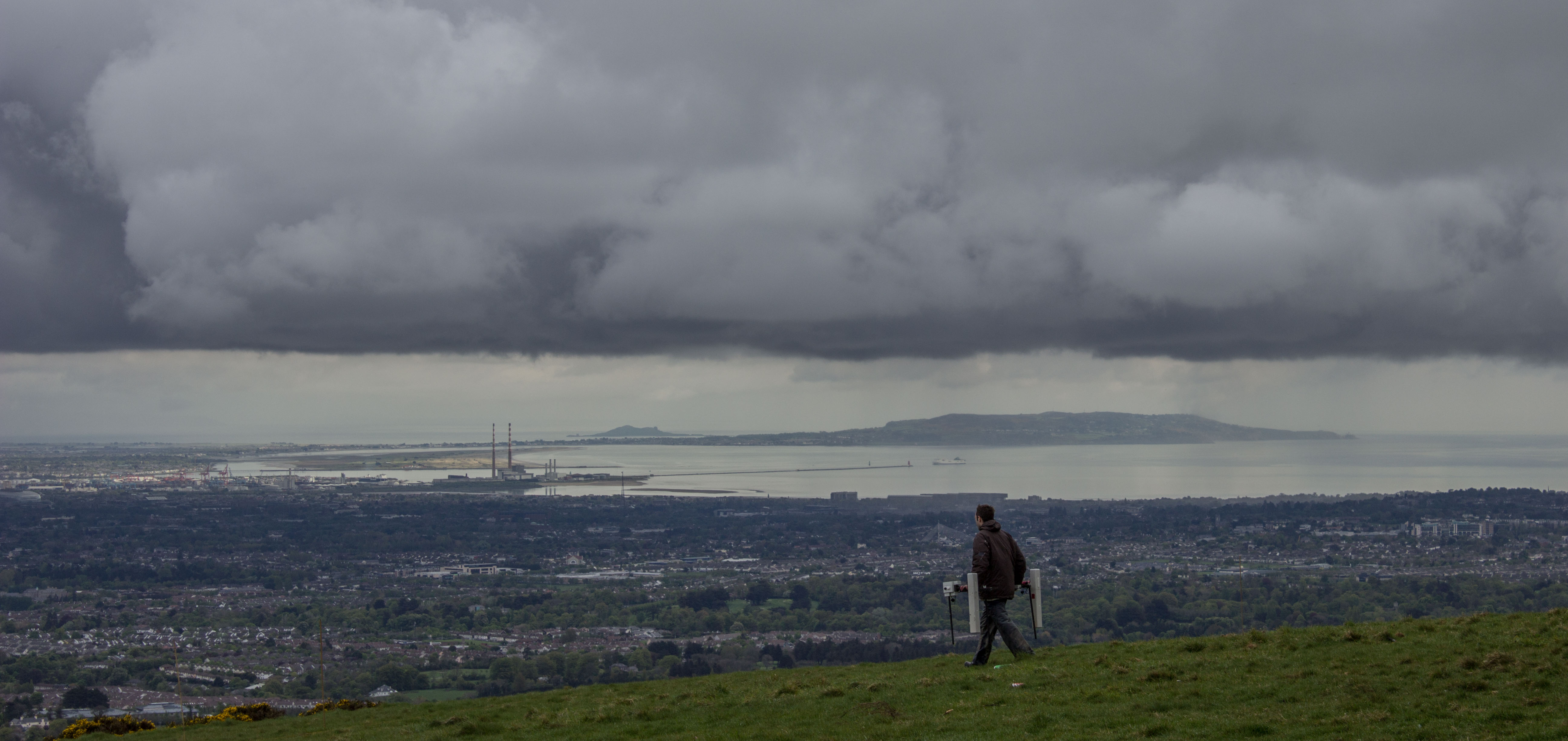
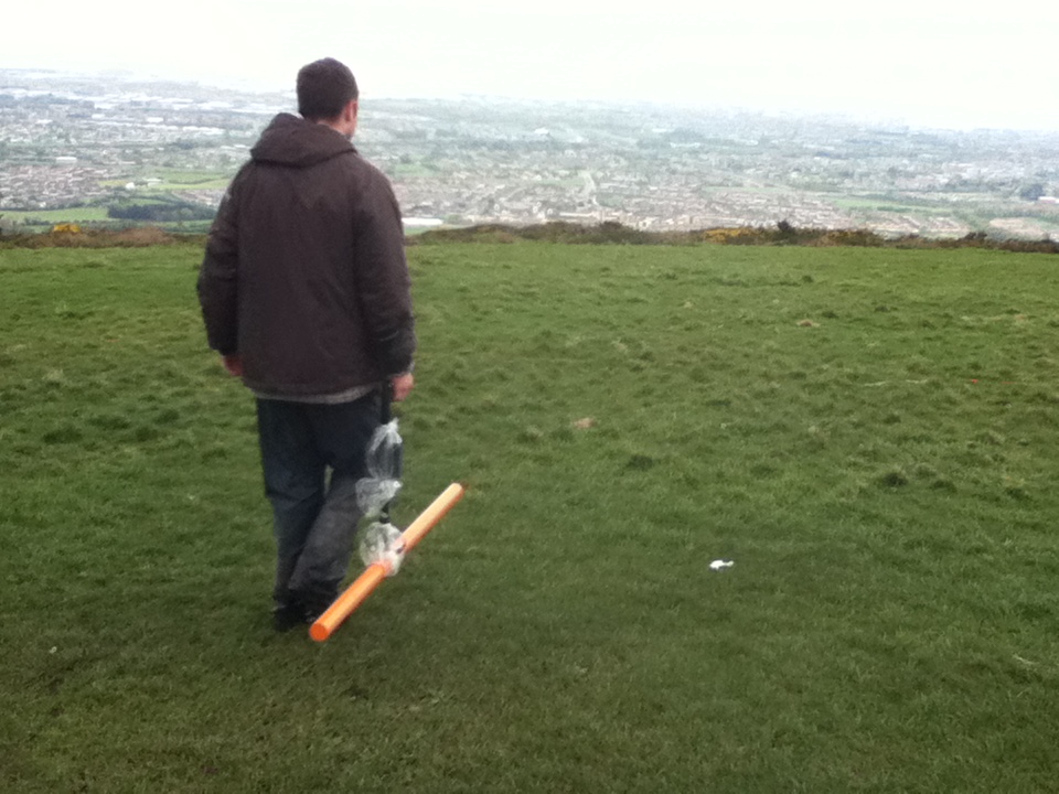
Magnetometry and a great view of Dublin City from Mountpelier Hill. Image: Abarta Heritage

Magnetometry and a great view of Dublin City from Mountpelier Hill. Image: Abarta Heritage

Project: The Hellfire Archaeology Project

Location: The Hellfire Club, Mountpelier Hill, Co. Dublin

Year: 2014

Client: The Hellfire Club Archaeology Project, on behalf of Abarta Heritage and South Dublin County Council

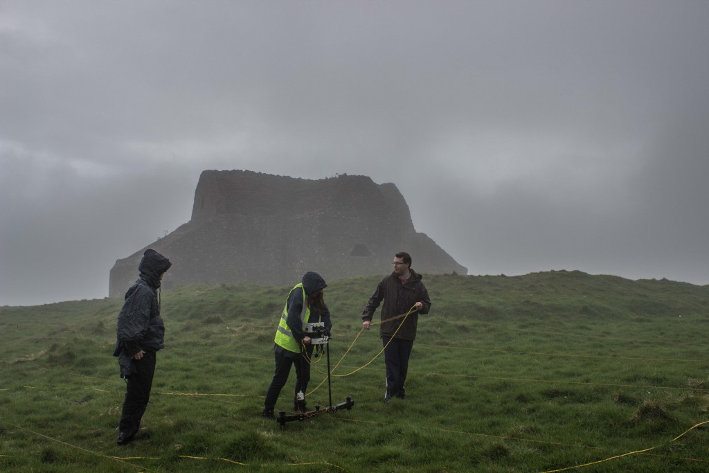
Aim: The purpose of the survey was to assess two Neolithic Passage Tombs  on top of Mountpelier Hill and the land surrounding the 18th Century Hellfire Club. The site was investigated with high resolution Magnetometer, Electromagnetic Induction and Earth Resistance Surveys, as well as LiDAR.

Community Engagement: 3 volunteers worked with Earthsound geophysicists over 3 days (volunteer labour contribution: €986)

Outcomes: The 2014 geophysical survey results were used to target a series of excavations in 2015 by the Hellfire Club Archaeology Project.

The geophysical survey was carried out as part of The Hellfire Archaeological Project in conjunction with Abarta Heritage. The site is located on top of Montpellier Hill in the Dublin Mountains which affords it a panoramic view of Dublin City and Bay. The summit of Monpellier Hill contains the remains of a hunting lodge built by the politician William Connolly in 1725. Adjacent to this is the probable remains of a prehistoric monument and it is thought that the lodge itself may have been constructed of stone robbed from these monuments.

According to folklore the roof had been blown down by a phantom from one of the tombs and Connolly had the roof reconstructed in stone.  Subsequent to Connolly’s death, the lodge lay in disuse for up to 10 years when it was leased by his widow Katherine to the Earl of Rosse, Richard Parsons. Parsons was a well known socialite and one of the ‘Young Bucks of Dublin’, a group of aristocrats who allegedly engaged in debauchery and possible Devil-worship, essentially what was to become the Hellfire Club. There are no direct accounts of Hellfire Club meetings occurring at Connolly’s Lodge on Montpellier Hill, however it is highly likely owing to its isolated location and association with Parsons.

Annacarty Remembered: RIC Barracks Survey

Magnetometry survey at the RIC Barracks

Magnetometry survey at the RIC Barracks

Project: Annacarty Remembered: RIC Barracks, Co. Tipperary.

Year: 2016

Client: Wolfhound Archaeology, funded by Tipperary County Council, Ireland 1916-2016 and The Heritage Council.

Aim: In June 2016, we carried out extensive Magnetometer, Electromagnetic Induction, Ground Penetrating RadarEarth Resistance Surveys and Metal Detection surveys at the RIC Barracks in Annacarty as part of a large commemoration event which was also filmed by RTE’s new television series John Creedon’s Epic East. The film crew were very interested in the geophysical survey and obtained some great drone and GoPro footage of our work.

Community Engagement: 1 volunteer worked with Earthsound geophysicists for 1 day (volunteer labour contribution: €164). The survey was filmed for RTE television and culminated in a large commemoration on the last day of survey, attended by more than 220 people, with Earthsound geophysicists on hand to explain the survey, it’s purpose and findings.

Outcomes: The 2016 geophysical survey culminated in a large commemoration ceremony (see below) attended by local school children and adults, the Army and many local politicians. The survey results will be integrated in to a management plan for the site.

The geophysical surveys were carried out as part of a research project managed by Wolfhound Archaeology, funded by Tipperary County Council, Ireland 1916-2016 and The Heritage Council. The research formed part of the Annacarty Remembers event, which commemorated the events of the War of Independence and Civil War.

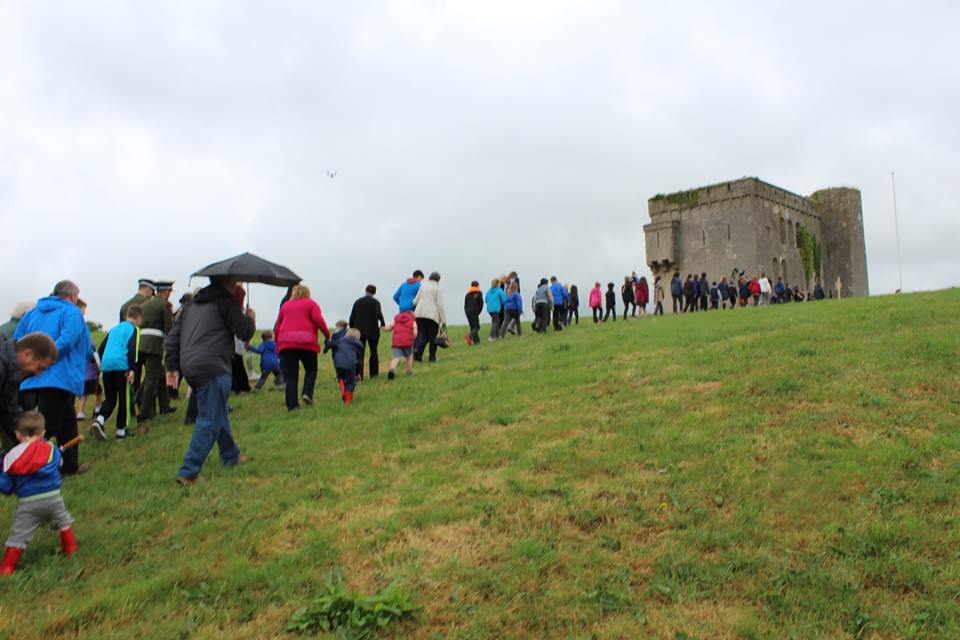
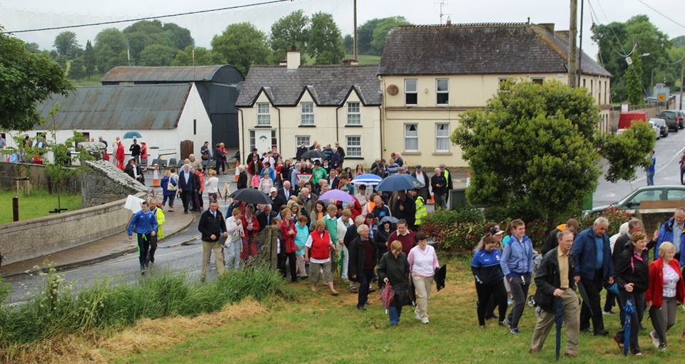
The school children lead the procession up the hill towards the Barracks.

School children lead the procession up the hill towards the Barracks.

Annacarty Barracks, which was originally constructed as an RIC barracks in the early 19th Century, saw considerable action during the conflicts prior to the foundation of the Irish state.

In the spring of 1922, the truce had been signed and the barracks handed over to the volunteers. The children of Annacarty N.S. were marched up the hill to the barracks by the principal, Mr. Slattery and sang Amhrán na bhFiann for the volunteers as they raised the tri-colour.

The procession recreated the original event in 1922.

The procession recreated the original event in 1922.

On June 10th 2016, the event was recreated by more than 220 school children, local residents and visitors. The building bears the scars of these battles but is otherwise virtually untouched since it was burnt out after a short but violent siege in 1922 during the Civil War.

The Annacarty Remembers gathering walks up the hill to the Barracks.

The Annacarty Remembers gathering walking up the hill to the Barracks.

The surveys were led by Heather Gimson and supported by Dr James Bonsall, Darren Regan and Cian Hogan, who used various geophysical instruments to map additional structures around the barracks and carried out a detailed photogrammetry survey.

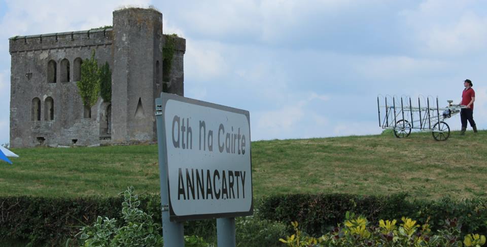
The magnetometer cart at the RIC Barracks

The magnetometer cart at rest by the RIC Barracks while John Creedon does some filming

Recording bullet holes in the wall. In the meantime, the 'Bone Detector' takes a snooze.

Recording bullet holes in the wall. In the meantime, the ‘Bone Detector’ takes a snooze.

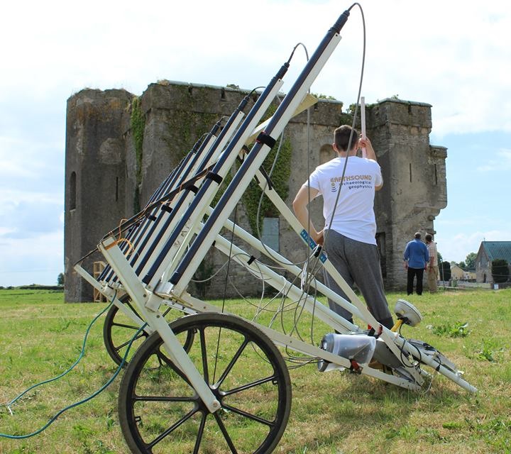
Magnetometry and EMI carts

Magnetometry and EMI carts

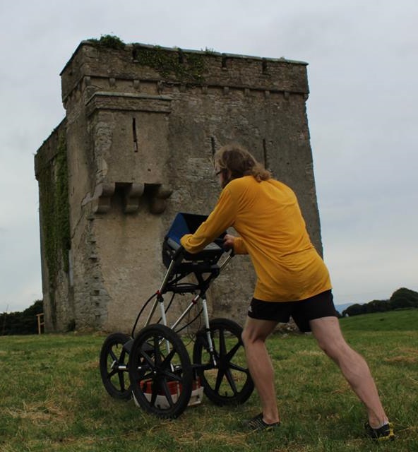
GPR in action at the RIC Barracks

GPR in action at the RIC Barracks

We enjoyed wonderful hospitality from the people of Annacarty, who really welcomed us to their village. Particular thanks are due to Tom Tuohy, The Parish Shop & Tea Rooms and the Crossroads Pub (which kept us – and the dog – in great health with lots of ice creams and drinks.

Duncannon Fort, Co. Wexford

Project: Duncanon Fort, Co. Wexford

Location: Duncannon, Co. Wexford

Year: 2016

Client: Stafford-McLoughlin Archaeology

Funding: County Kildare Archaeological Society and the Kildare County Council Community Heritage Grant Scheme.

Aim: Earthsound Archaeological Geophysics were commissioned by Ms. C. McLoughlin of Stafford McLoughlin Archaeology on behalf of Wexford County Council to execute a geophysical survey in land adjacent to the Duncannon Bastion Fort as part of a conservation plan being carried with assistance from the Heritage Council, within the townland of Duncannon, Duncannon Village, County Wexford. The fort contains a church and a castle and it is believed that it may originally have been the site of a promontory fort owing to the derivation of the name meaning ‘Conan’s Fort’. Our main objectives were to determine the presence or absence of buildings and possibly grave plots associated with Duncannon Fort which are reputed to lie within the survey area and to investigate for any possible metallic artefacts which may be related to the usage of the fort. Earthsound carried out a comprehensive geophysical study of the site which included Magnetometry, Earth Resistance, Electromagnetic Induction and Metal Detection.

Outcomes: The geophysical surveys have revealed an extensive range of potential archaeological features which suggest the presence of multi-phase occupation. This activity appears to be concentrated in the northern field, while the central and southern fields have been heavily impacted by later activity such as the construction of a cinder block wall and soil deposition. Within the northern field a series of parallel and interconnecting boundaries have been detected. These could relate to agricultural activity or be associated with habitation. A number of circular possible enclosures were identified. These are unlikely to be contemporary with the fort but may indicate occupation on the site prior to the installation of military activity. The presence of numerous possible pits and four possible industrial anomalies as well as a series of possible structures down the western extent of the northern field suggests a large amount of habitation activity once existed on the outer edge of the fort. When the geophysical results are combined with the metal detection ‘hits’ a complicated picture emerges suggesting that the fields, as well as being used for habitation, may have seen warfare or at least the practicing of warfare.

NRA/TII Geophysical Guidance Document Now Online

The use of archaeological geophysics on national road schemes between 2001 and 2010 has been comprehensively reviewed as part of a National Roads Authority (NRA, now known as TII – Transport Infrastructure Ireland) archaeological research project funded through the NRA Fellowship Programme. The study, which was awarded funding in 2010, was carried out by James Bonsall, Dr Chris Gaffney and Professor Ian Armit from the University of Bradford in the UK. Earthsound Archaeological Geophysics acted as the university’s industrial partner in the research.

The research delivered a set of guidelines entitled Preparing for the Future: a re-appraisal of archaeo-geophysical surveying on Irish National Road Schemes 2001-2010, which has been used by the NRA/TII to commission new geophysical surveys based on lessons learnt from the study. The document has recently been published online by the NRA/TII and other outlets.
selection-page-001

The guidance document includes:

  • a review of previous geophysical surveys on NRA road schemes,
  • typical geophysical responses to a range of archaeological features, soils and geologies
  • a discussion of the limitations of various methods
  • advice on how to carry out surveys in ‘challenging’ conditions, landscapes and geologies
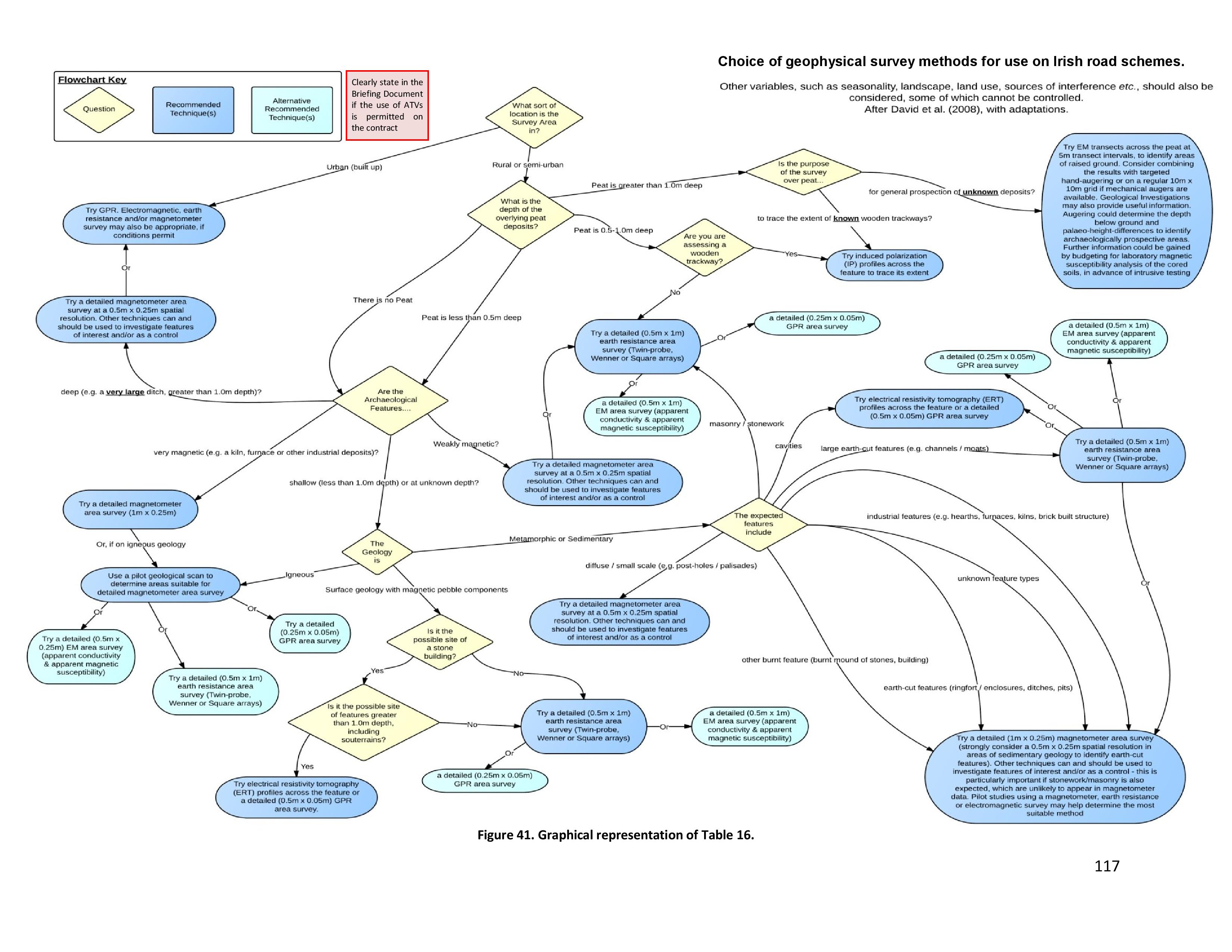
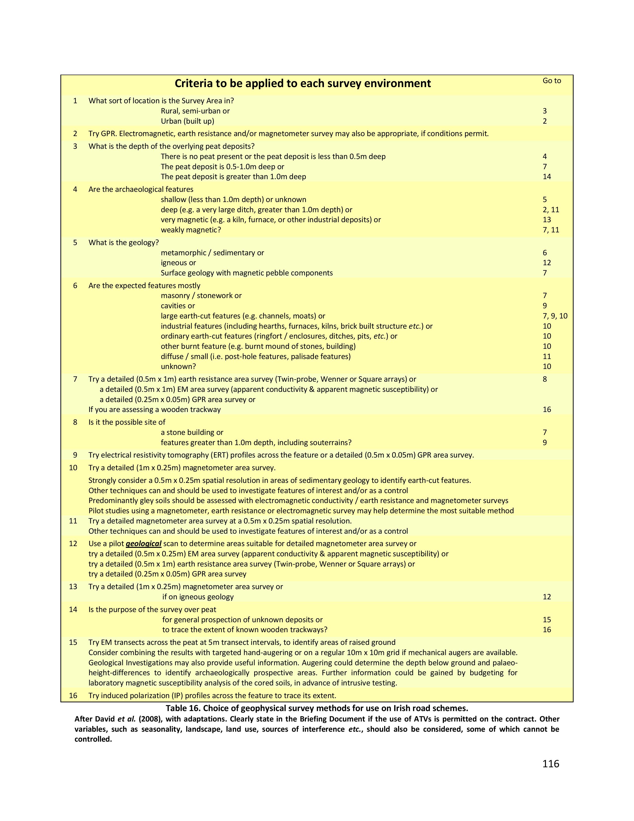
  • a Specification Key that assists non-geophysicists to determine the most appropriate geophysical technique(s) for a given study area or receiving environment.
selection-page-006

Choice of geophysical survey methods for use on Irish road schemes. (Bonsall, J, Gaffney, C & Armit, I 2014. Preparing for the Future: a re-appraisal of archaeo-geophysical surveying on Irish National Road Schemes 2001-2010. Report by the Division of Archaeological, Geographical and Environmental Sciences, University of Bradford.)
selection-page-005

Choice of geophysical survey methods for use on Irish road schemes. (Bonsall, J, Gaffney, C & Armit, I 2014. Preparing for the Future: a re-appraisal of archaeo-geophysical surveying on Irish National Road Schemes 2001-2010. Report by the Division of Archaeological, Geographical and Environmental Sciences, University of Bradford.)
selection-page-002

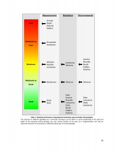
Idealised performance of geophysical techniques upon principle Irish geologies. (Bonsall, J, Gaffney, C & Armit, I 2014. Preparing for the Future: a re-appraisal of archaeo-geophysical surveying on Irish National Road Schemes 2001-2010. Report by the Division of Archaeological, Geographical and Environmental Sciences, University of Bradford.)
selection-page-003

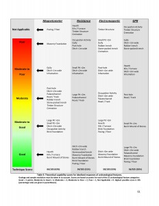
Theoretical capability scores for idealised responses of archaeological features. (Bonsall, J, Gaffney, C & Armit, I 2014. Preparing for the Future: a re-appraisal of archaeo-geophysical surveying on Irish National Road Schemes 2001-2010. Report by the Division of Archaeological, Geographical and Environmental Sciences, University of Bradford.)
selection-page-004

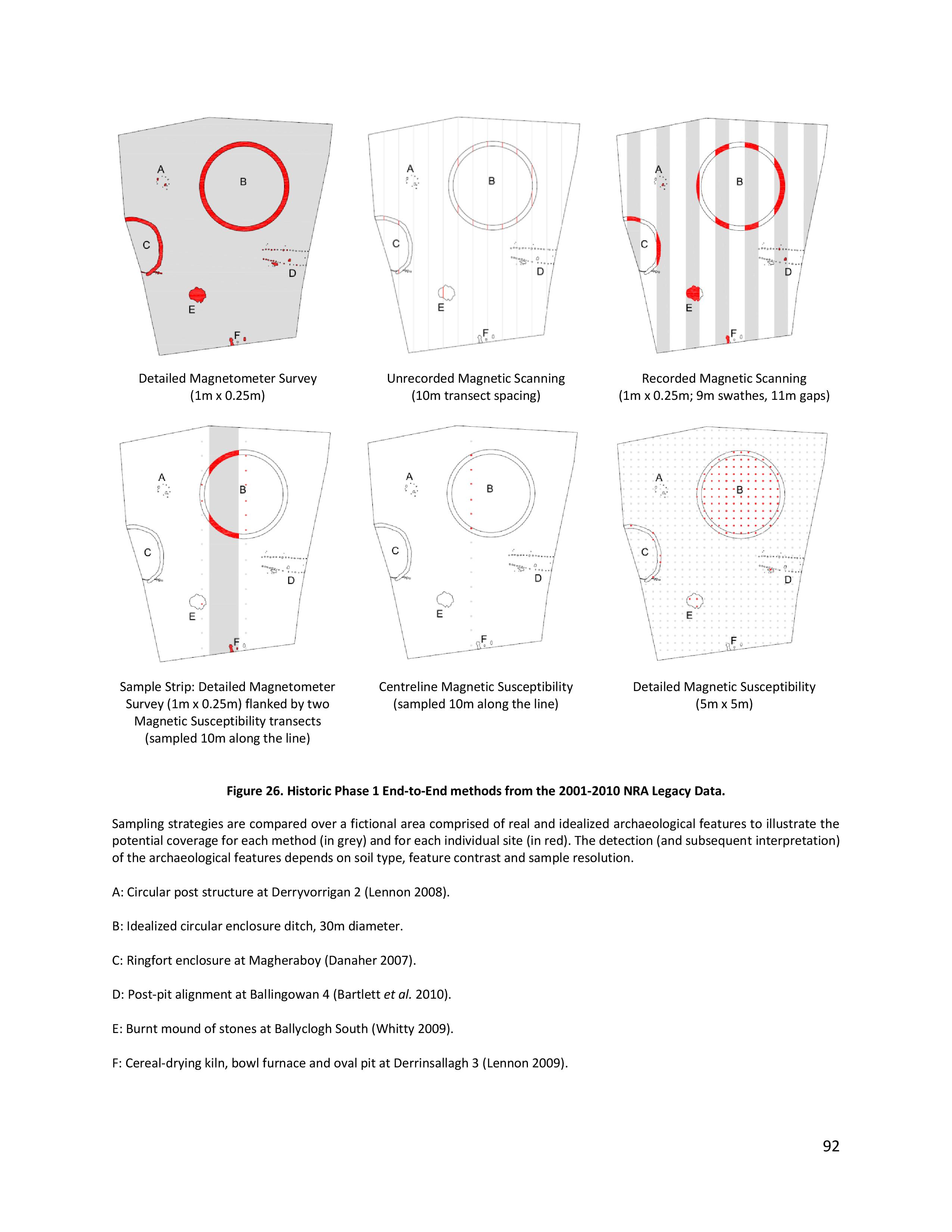
Historic methods of prospection from the 2001-2010 NRA Legacy Data. (Bonsall, J, Gaffney, C & Armit, I 2014. Preparing for the Future: a re-appraisal of archaeo-geophysical surveying on Irish National Road Schemes 2001-2010. Report by the Division of Archaeological, Geographical and Environmental Sciences, University of Bradford.)

Executive Summary of the Guidance Document

(Bonsall et al. 2014: 1)

This [guidance] document reviews Legacy Data generated from 10 years’ worth of road scheme activity in Ireland to determine how archaeological geophysical surveys could be carried out on national roads in the future. The geophysical surveys were carried out by several different contractors across a range of challenging field conditions, geologies, weather and seasons. The research is based upon the results of linear schemes but also has validity for wider approaches. The findings of this research are based upon the compilation of all terrestrial archaeological geophysical surveys carried out on behalf of the National Roads Authority (NRA), a review of the success or otherwise of those surveys in comparison with ground-observed excavations and in combination with experimental surveys that tested previously held assumptions or knowledge to determine best practice methods for the future.

The use and success of geophysical surveys in Ireland differ quite significantly from those in the UK, from where many of the methods of assessment were derived or adapted. Many of these differences can be attributed to geology. Ireland has a very high percentage of Carboniferous limestone geology, overlain mostly by tills and frequent occurrences of peat. These soils can reduce, to some extent, the effectiveness of magnetometer surveys; the most frequently used geophysical technique in Ireland. However, magnetometer data can be maximised in these cases by increasing the spatial resolution to produce effective results. An increase in spatial resolution is also effective generally, for enhancing the chances of identifying archaeological features by discriminating between archaeological and geological anomalies as well as increasing anomaly definition and visualisation of small and subtle archaeological features.

Outputs of the Research

Other outputs of the NRA Fellowship research have included:

  • A PhD for James Bonsall,  which was awarded in 2014.
  • James was selected as a finalist to present his research at the prestigious Transport Research Arena 2012 conference and was awarded the silver medal in the Environmental Pillar for his presentation.
  • A preliminary review of progress in Issue 6 of Seanda NRA Archaeology Magazine (published in December 2011) and a paper at the 2012 NRA National Archaeology Seminar. This paper, co-authored by James Bonsall, Dr Chris Gaffney and Professor Ian Armit, was published in the subsequent seminar proceedings in autumn 2013.
  • An online database from which NRA-commissioned geophysical reports. The NRA Archaeological Geophysical Survey Database was launched in April 2013 and an article about this important online resource was published in Issue 8 of Seanda.

Related publications

Bonsall, J  2011  ‘Ten years of archaeogeophysics’, Seanda, No. 6, 38–9.

Bonsall, J, Gaffney, C & Armit, I  2013  ‘Back and forth: paving the way forward by assessing 10 years of geophysical surveys on Irish road schemes’, in B Kelly, N Roycroft & M Stanley (eds), Futures and Pasts: archaeological science on Irish road schemes, 1–13. Archaeology and the National Roads Authority Monograph Series No. 10. National Roads Authority, Dublin.

Bonsall, J, Gaffney, C & Armit, I  2014  Preparing for the Future: a re-appraisal of archaeo-geophysical surveying on Irish National Road Schemes 2001-2010. Report by the Division of Archaeological, Geographical and Environmental Sciences, University of Bradford.

Bonsall, J, Sparrow, T, Gaffney, C, Armit, I & Swan, R  2013  ‘Underground, overground’Seanda, No. 8, 14–15.
Merry Christmas

We’d like to wish you all a very Merry Christmas, from everyone here at Earthsound.

jibjab

Merry Christmas, from Earthsound!

It’s Christmas Eve Eve, and as I sit here writing this, I have the chance to reflect on 2015. It’s certainly been a year of changes. We were joined by Dr Rob Fry on a number of projects (including the largest we’ve ever worked on) in the Spring, when we invested in new staff and the latest state-of-the-art geophysical instruments and soil analysis equipment.

Earthsound2015_2We’ve worked on some fantastic projects this year, including Woodstock Castle (Athy), Lea Castle, the Kinsale Battlefield Project, the Wonderful Barn, the Dowth Estate, we returned to Rathnadrinna Royal Fort and we’ve worked with the School of Irish Archaeology at their amazing new urban outreach project Dublin Uncovered, based in the Liberties. In April we worked in partnership with IT Sligo Applied Archaeology students to survey part of the monastic enclosure at Drumcliff.
As well as our conventional geophysical surveys for both private sector and research projects, we’ve also carried out metal detection surveys and developed our soil analysis services: we’ve collected soils across medieval enclosure complexes (which we’re in the process of analysing, using a variety of geochemical and geoarchaeological techniques) and extensive geophysical and geoarchaeological soil analyses of the ‘mysterious pit fields of Roscommon’ with Sligo-Leitrim Archaeological Services. We’ve also launched our new digitizing service.  Over the last few months, you’ll have been as likely to find us in the field carrying out geophysical surveys as you would to find us auguring, coring or back at the office grinding soils or digitising plan and section drawings. Earthsound2015

We’ve also been out and about on the conference circuit. Earthsound sponsored and attended the Weather Beaten Archaeology Conference at IT Sligo and Earthsound staff attended the Neolithic Ireland: Europe and the Atlantic Conference in Sligo and presented at the European Association of Archaeologists Conference in Glasgow and the 11th International Conference on Archaeological Prospection in Warsaw, as well as continuing the Earthsound Lecture Series. It’s been an eventful year and we can’t wait to see what 2016 will bring.

Merry Christmas, Everybody and all the Best for 2016!

James

Dr. James Bonsall, Director

Dr Bonsall’s Tutorial on the Historic Environment Viewer

Earthsound director Dr James Bonsall gives a brief tutorial on using the new Historic Environment Viewer and gives an overview of some new additions.

Yesterday, the Department of Arts, Heritage and the Gaeltacht launched the new Historic Environment Viewer which combines the databases of the National Monuments Service Sites and Monuments Record (SMR) and the National Inventory of Architectural Heritage (NIAH), and replaces the previous National Monuments Viewer.

New features include:

  • Enhanced Query and Draw Functions
  • Architectural Heritage
  • High quality Digital Globe aerial photographs

Lecture at Kilmovee Community Centre: ‘Archaeology of Kilcashel’

Archaeology of Kilcashel.

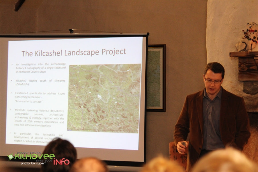
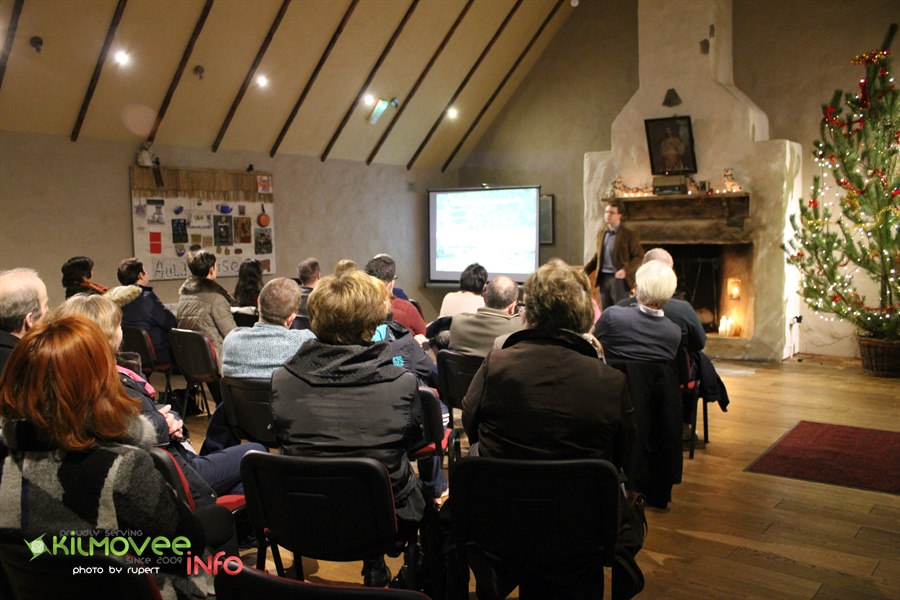
Dr James Bonsall, director of Earthsound Archaeological Geophysics and Lecturer at IT Sligo gave a talk on the latest findings from the Kilcashel Landscape Project at the Kilmovee Winter Lecture Series on Tuesday December 15th, in the Kilmovee Community Centre, Co. Mayo.

23162820213_54cb7c942d_b

Dr James Bonsall talks at the Kilmovee Winter Lecture Series about the Kilcashel Landscape Project at Kilmovee.

James’ talk focused on the range of archaeological sites in Kilcashel, from Bronze Age fulacht fia to medieval cashels and 19th century mud cabins.

James was also interested in people’s use,  experience or memories of the archaeological sites in Kilcashel townland – the cashels that are no longer there, Father Henry’s Fort and any other memories of buildings, archaeology and folklore. These all contributed to a Database of Archaeology in Kilcashel townland, which led to the longest Q&A session in the history of the Kilmovee Winter Lecture Series!

23421671669_2a05687bbe_b

Woodstock Castle, Athy, Co. Kildare

Yesterday, Earthsound Archaeological Geophysics had the pleasure of returning to Athy in County Kildare to carry out magnetometry and electromagnetic induction surveys at Woodstock Castle. This is the latest in a number of projects that we have carried out in Athy over the past few years, which have included geophysical and LiDAR investigations of the historic Town Walls and Black Castle Tower which have been a part of the ongoing efforts of the Athy Heritage Centre-Museum to inform locals and visitors alike on the wonderful history of their town! rsz_wp_20151015_12_30_52_pro__highres

Cian Hogan and Darren Regan of the Earthsound Field Division braved a cold October morning to survey the environs of the castle. Darren was filmed for a short video that documented the surveys for the benefit of the local national school.

rsz_wp_20151015_12_59_29_pro

We love returning to Athy each year to add a little bit more knowledge to the development of this important medieval town and this is just the latest in a long line of projects for the Athy Heritage Centre-Museum!

Since the year 2013, Earthsound have had an ongoing relationship with the Athy Heritage Centre-Museum in connection with The South Kildare Medieval Heritage Project on a variety of projects which encompass geophysical surveys, historical research and public outreach campaigns.  The first project we engaged in involved a number of geophysical surveys in order to detect the location and morphology of the historic town halls, an investigation we returned to again in another area of the town in October of 2016. The work carried out in October 2016 involved the use of Ground Penetrating Radar and led to the discovery of a number of significant anomalies such as possible walls, defensive structures and remains associated with a mortuary site.

As part of these ongoing projects, Earthsound has spoken and given demonstrations at a number of community activities based in the town in order to explain the work we have carried out and to hopefully give a greater understanding to the residents of the archaeological and historical heritage that surrounds them.

Athy is part of the Irish Walled Towns Network and Earthsound have undertaken similar studies on Cashel Walled Town and Castledermot Walled Town.